
This urban design project has been prepared for Spring Studio to illustrate our understanding of master planning and community within Rick
Roberts Way, Stratford. This communication tool will help outline how the design of the proposed development at Rick Roberts Way has been considered from the start of the development process, illustrating objectives of good design and community involvement. To inform these decisions the wider context of the surrounding site has been analysed, the needs for residents, visitors, and tourists alike. Acting on principles of sustainable transport, good public space, affordability, inclusivity, and healthy functional mix.
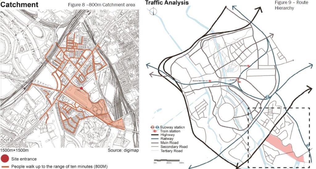
According to the traffic analysis, compared with traffic observations around the site the accessibility to the northern section of the site is significantly better. However, let it be noted that Abbey Road DLR station is the closest to the site. This would require improved accessibility to that station takenshaw and Bunn 2015 found that the acceptable distance for people to walk to a public transport node is approximately 800 m, Transport For London accepts 900 m.
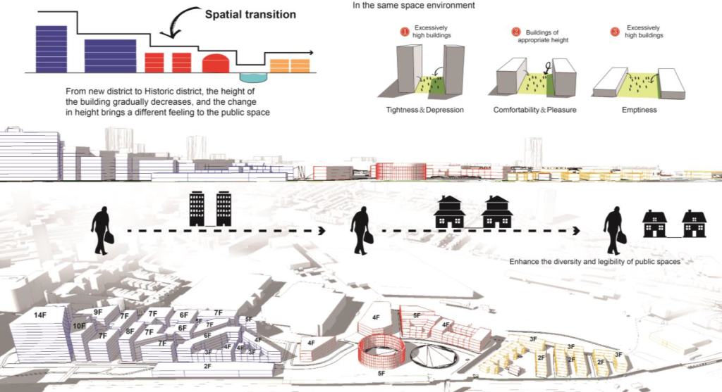
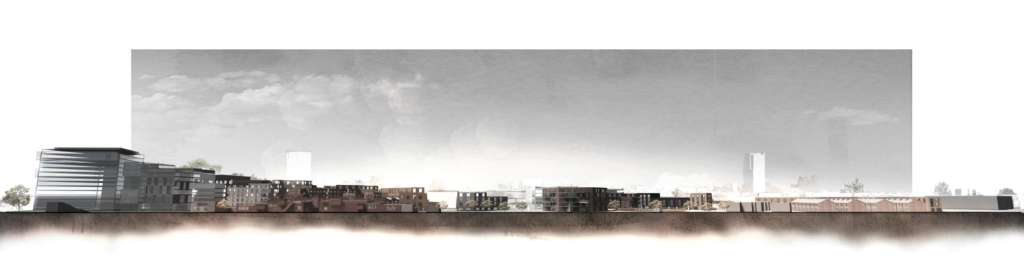
Over recent years, parts of Stratford have been transformed by new large scale and often piecemeal developments. This has resulted in incoherent urban scale and form which whilst appropriate for some part of the sub area has compromised the areas overall character and legibility.
As noted in responsive environments (Bentley et al, 1985 certain types
of physical features play key roles in the way people see their local area. At present the site is poorly connected up to the surrounding area and in itself impermeable.
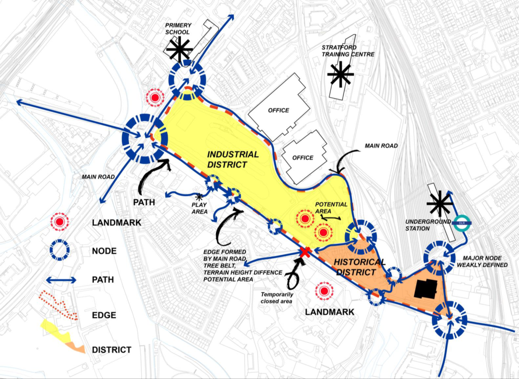
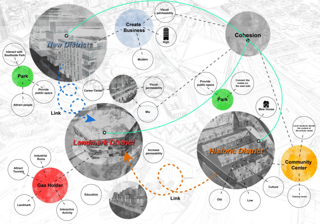
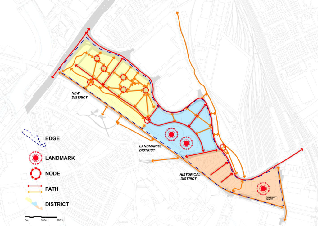
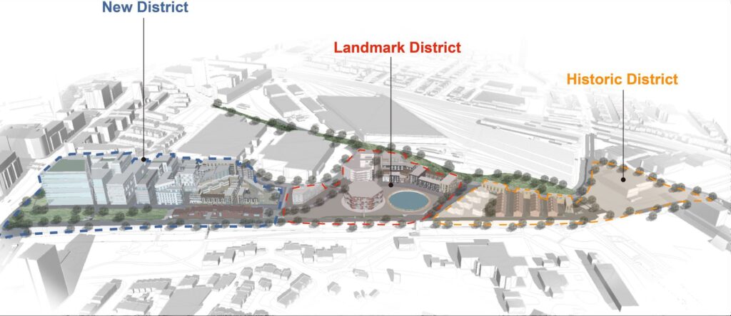
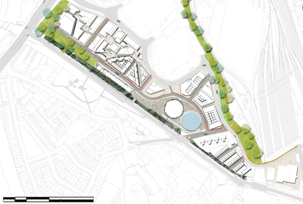
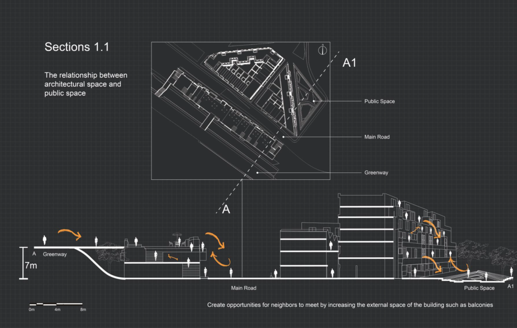
These character areas are the building blocks to the different areas within Rick Roberts Way and subsequent development reacts to the district which it is in. The Greenway will be our primary link between all character areas as it passes through each zone. However, let it be noted, whilst there will be different areas within the development there will be no exclusive each area is accessible and inclusive to all who wish to use it.
This development that were would be a significant improvement in quality and quantity of paths through the site, connecting to the Greenway and surrounding area. There created in the site are multiple landmarks, however the most noteworthy would be the Creative Gas Holder and Community Hub. These two landmarks aim to integrate the site with the surrounding community and almost give the existing communities permission to use this new space. There are many new nodes through the site, including the plazas through the new district. These entirely pedestrianised routes open up to plazas, almost as if you would be getting lost in Barcelona, enhancing that sense of richness, variety and legibility. The creation of the 3 character areas also enhances legibility as now a resident could identify where they could meet friends or colleagues
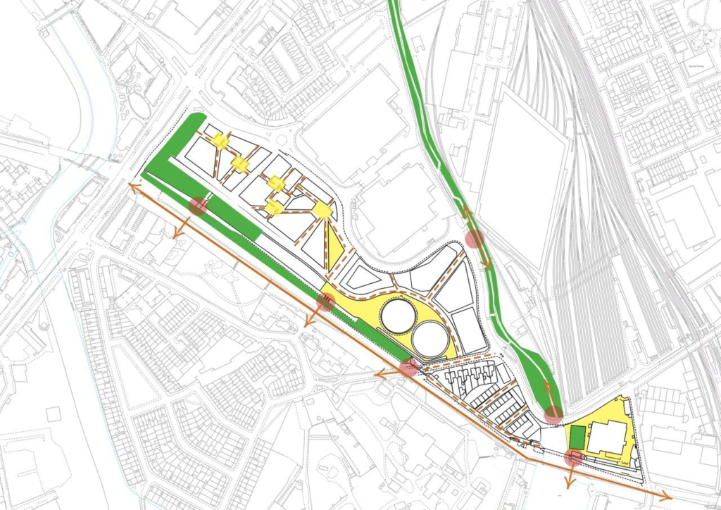
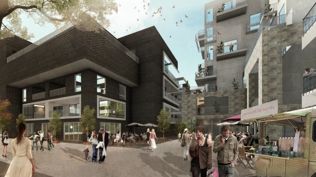
Core to our development principles is the idea of high quality public space As a result 49 of the space on site is publicly accessible. This has been done by eliminating spaces for cars in the new district, opening up spaces around the gas holders and community hub and mirroring the MOL on the north western side of the site.
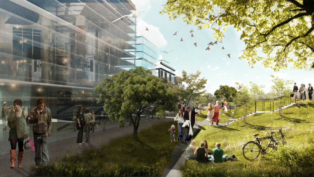
The image (below) illustrates a view from the north western section of the site looking down, parallel with the Greenway. There are aspects of connectivity where a new link has been installed connecting the site with the Greenway, Olympic Park and further afield. This space is also an extension of green space in this area of Stratford Additionally, there is
no through way for cars here just pedestrians and cyclists.
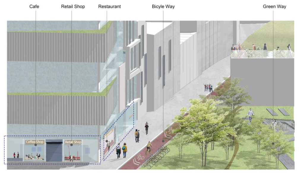
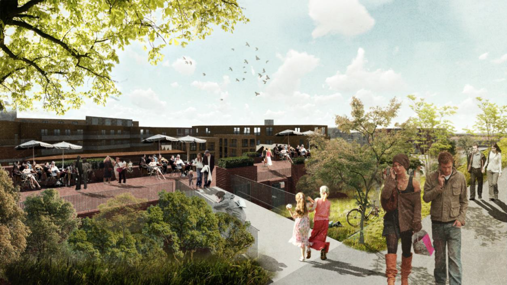
This image is taken as you entre the second section of the New District This area within the district has become less obviously new with the refined cladding and increased residential units. The move away from glass
signifies a transition into another character zone. However, we see from this illustration that there are still significant functional mix occurring in this area, as well another high quality public space.
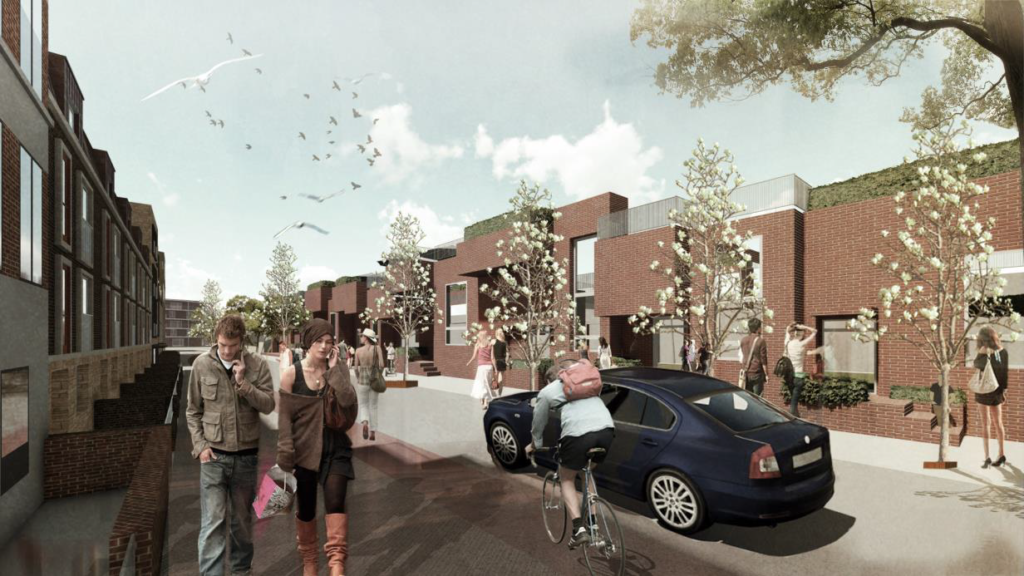
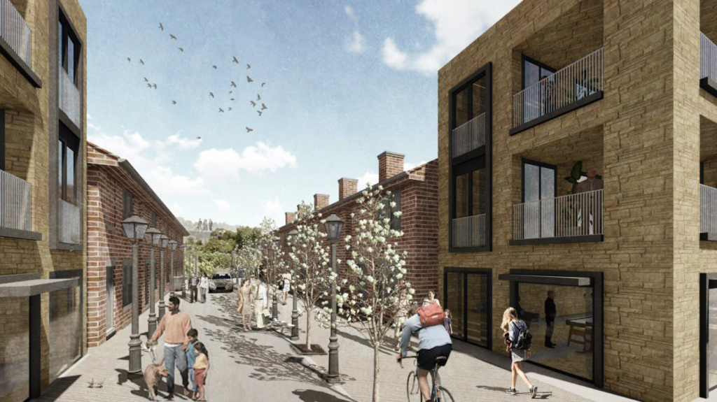
The image below illustrates the main road through the site, one of few roads to pierce the site. Along the main road will be a bi-directional cycle-way and greenery. As the image demonstrates this area has a more
residential feel, this due to the terraced homes on both side of the road.
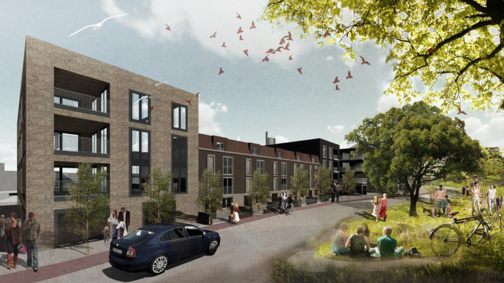
Looking on to the Creative Gas Holder from the bend in the road signifies the change in character area, from New District to Industrial District. This district houses more homes and recreational facilities over office space.
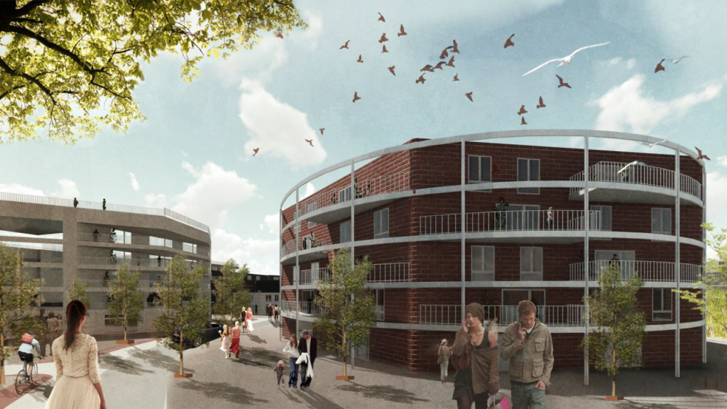
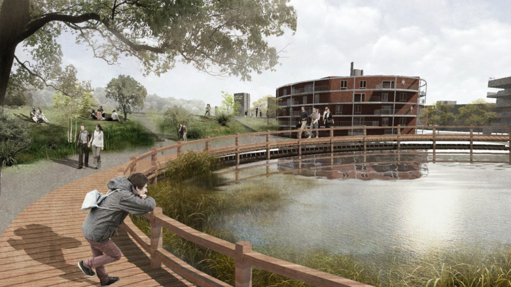
The CGH from the other side of the newly created public space. This
space integrates with the Greenway through new ramps and steps up too it. The second gas holder will be transformed into a pond to increase the bio diversity within the site and encourage wildlife to return to the area. This
space will be a more relaxing space where you might go to escape busy street life, nevertheless the homes that boarder the square will also act as a form of natural surveillance.
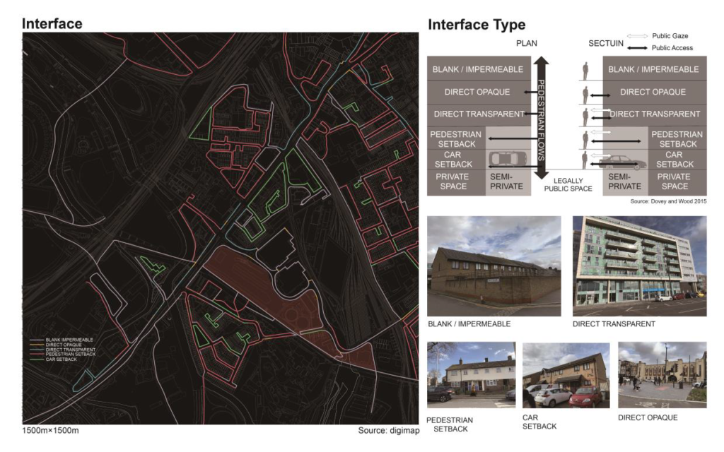
The proposal addresses the nature of rising house prices, gentrification and community by making a community hub, squares and parks, Pedestrianised zones and a Creative Gas Work site to accommodate anyone who may be displaced. This site will not be displacing anyone as the majority of the site is vacant, however if any happens they would be guaranteed a place in the new development. The development provides ample natural surveillance and aims to have no inactive frontages.
Tutor:
Patricia Lopes Simoes Aelbrecht
Students:
Nathan Goldup-John / Xuchen Zhang / Jixing Zhou